After doing some online research and hearing quite a bit about the massive destruction caused by Hurricane Irene in the Catskills, I thought it wise to actually previewing the Catskill Climbfest 200K permanent route before riding it next weekend with a few friends. I set out early this morning after filling up my new Prius for the first time at the first control and was astounded to pay only $29.00 for a full tank of gas. Yowser!
The first leg of the route was just fine. It was not until a few miles before the first control that a downed bridge made the route completely impassable. I found the asphalt surface of the small bridge totally washed away with only a one-foot wide wall remaining along the north side. I looked good and hard at this and decided that it probably wouldn't be the best idea to cross it with a bike on my shoulder and cleats on my feet. Luckily, I located a circuitous alternate road that only adds about four miles onto the route to cross that 15 feet of stream.

Back on the route, I found the climb up 23A uneventful, but halfway up the road is reduced to one lane for storm repairs but is currently passable and not congested. The descent into Phoenicia revealed increasing damage as I neared the town itself. The floodwaters have receded and the river now rages at a less destructive level, but storm damage and high water marks can be seen in all directions. The town of Phoenicia itself did not look as ruined as I feared and most of the shops appeared open for business, including the popular favorites Sweet Sue's and Mama's Boy.
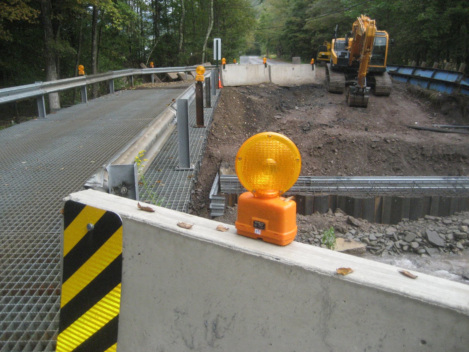
Route 28 was also reduced to one lane and I watched a large crew working hard in the light rain with all sorts of heavy equipment to repair the 1/2 of the road that was swept off by the (misnamed) Esopus Creek. Driving north, I passed a convoy of eight or nine US military transport vehicles bearing heavy excavating equipment and noticed more of the raw destructive power of water all around me. I noted the "Road Closed: Local Traffic Only" sign as I turned off Rt. 28 onto Oliverea-Frost Valley Rd., but pushed on with some hope that perhaps the roadway was either just a mess or passable by bike further up.

This road and the surrounding land must have been an outrageous torrent of river last week judging from the damage. I crossed an emergency bridge constructed within the past week to span the gap of about 30 feet of air and noticed that Oliverea Maple, a local sugar shack, and it's adjoining residential property were completely destroyed and condemned. The sign next to the front door revealed that not all of he owner's humor had been washed away with the floodwaters.
Just beyond this home, I noticed bright yellow sheriff's tape crossing the roadway barring any further progress. I parked and walked about 75 yards to see a gaping hole in what was once a smooth road. Like much of the Catskills, Oliverea-Frost Valley Rd is the only road that cuts through this clove (or valley). Rerouting is going to be a challenge. With a little luck, though, a reroute through a different clove should be possible. I'll have to check out the passage on that one tomorrow.


No comments:
Post a Comment